Visiting Central Australia is one of those quintessential Australian travel experiences. Below is some info that we have gleaned in our travels to the area…
Getting There (from the east coast)
Choosing a travelling route to Central Australia depends very much on your starting location, and what you want to see and experience along the way.
And there is plenty of ‘along the way’ – whichever route you choose, there are some seriously long distances involved. (Ditto if you are travelling from the west coast.)
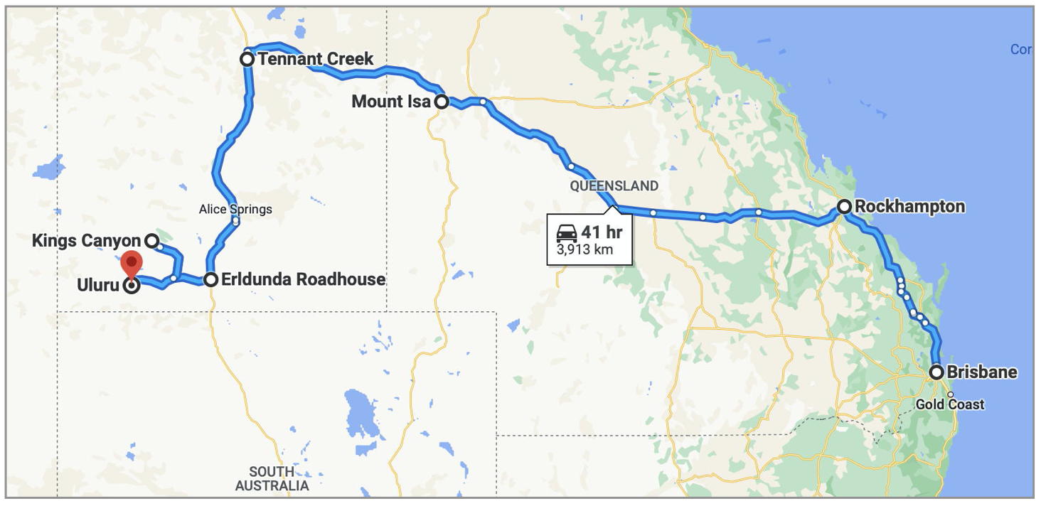
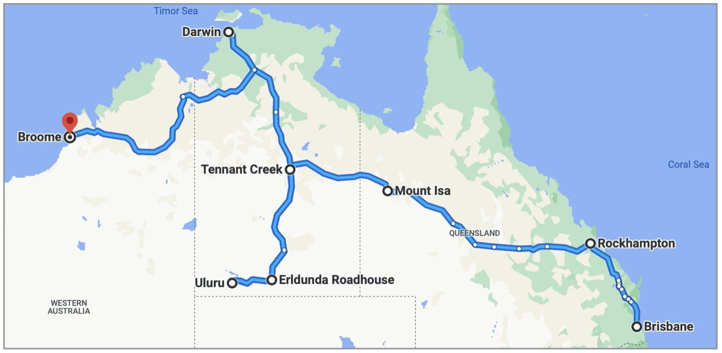
If you live on the east coast you can travel up the Queensland coast to Rockhampton, or Townsville, across to Mt Isa, then on to Tennant Creek in the Northern Territory. You can then drive south to Alice Springs, then on to Kings Canyon and Uluru. (Or head north to Kakadu and Darwin.)
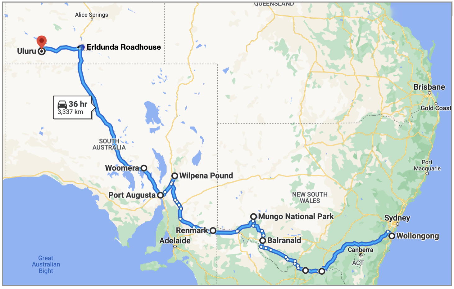
Alternatively you might travel down the NSW coast, along the Victorian coast, across to Adelaide, then up through Port Augusta and on to the Northern Territory via Woomera and Coober Pedy….

Or take in some of western NSW, including Dubbo, and maybe Wilcannia and White Cliffs, before travelling into South Australia through Broken Hill…..

Or maybe explore the townships along the Murray River, with side trips to Mungo NP and Wilpena Pound NP on the way through to Port Augusta….
Another option for those who head all the way up to Darwin is to travel west across to the Kimberley and down the WA coast, completing the loop back across the Nullabor…..
Which ever route you take, there are some very long distances involved. Avoid driving at night, when you have to deal with the added complication of nocturnal animals on the roads – not only kangaroos, but also the occasional camel and wandering farm livestock. (We met people who had come across camels sitting on sealed roads after sunset to soak up the warmth stored in the bitumen!)
We try not to overdo the driving each day. Our longest day on the road was just over 5 hours (Coober Pedy to Erldunda Roadhouse). In days gone by we might have contemplated longer days, but in our more mature years there are limits!
Roads

Our van is 2WD, so the first questions that came to mind when planning our trip through the Centre related to road surfaces and 2WD access.
We needn’t have worried about it – the roads to all major centres are sealed. Keep in mind that tourist coaches and road trains ply many of these routes, so the roads have been built to a standard to cope with that sort of regular traffic.
Roads heading out to some scenic sites are gravel, but quite navigable in 2WD so long as the weather is good.
Even roads designated as 4WD routes can have surprisingly good surfaces if they have been recently graded – but you can never be sure! We met a family who had just towed their van up the Oodnadatta track, travelling at over 90 km/h on some sections that had been graded, and for over an hour at 20-30 km/h on ungraded corrugated sections.

On our recent trip to the Centre we travelled in May, which is on the ‘shoulder’ of the main season of June / July / August – and even then the Stuart and Lasseter highways were like a grey nomad superhighway. Non-stop Caravans and Motorhomes, mixed in with the occasional 40 – 50 metre long road train barreling along at 100kmh.
Also be aware that many of these roads can be closed after heavy rain. It doesn’t happen very often, but if a main access road is closed you could be stuck on the other side until floodwaters recede.
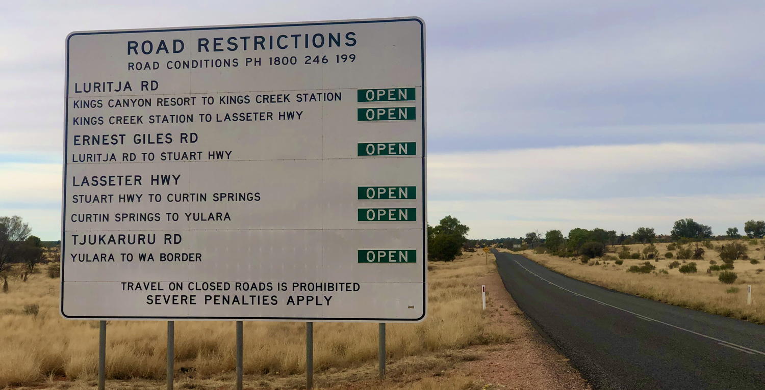
If you will be travelling off the regular black-top trail – exploring the Oodnadatta or Birdsville Tracks for example, or the Mereenie Loop Road or Ernest Giles Road (alternative routes between Alice Springs and Kings Canyon) – then more careful planning is required. The condition of these roads varies depending on weather, they are 4WD only, and may require an entry permit.
More info: NT Roads and Travel Permits
Also be aware that online mapping services may not consider these road limitations, and will simply plot the shortest route between two locations. For example, try using Google Maps to plot a course from Alice Springs to Kings Canyon – Google will suggest a route via Mereenie, which is the shortest distance, but requires an entry permit, and is not suitable for 2WD vehicles.
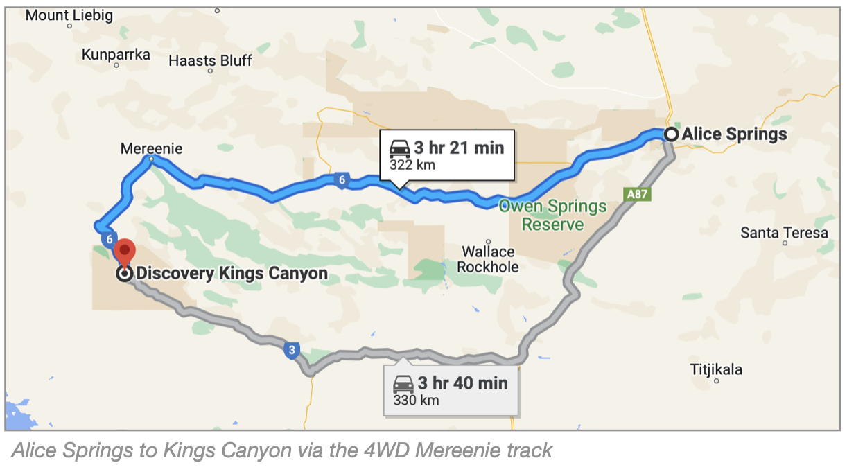
2WD vehicles should travel south from Alice Springs to Erldunda Roadhouse, then west to Uluru and Kings Canyon – all sealed roadway.
Fuel
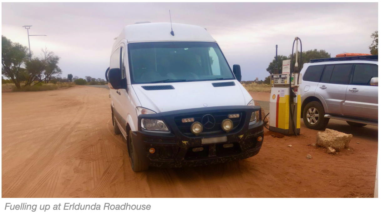
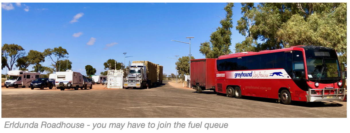
Fuel is not generally a problem on the tourist trail, if you fill up whenever you can. There is fuel available on the major routes every 300 – 400 kms. It is generally a little more expensive than in the coastal cities, but not too bad. Erldunda Roadhouse won the prize for the most expensive diesel on our trip – $2.95 per litre. (Coast price at the time was around $2.00 per litre.)
Be aware of your vehicle’s rate of fuel consumption (Litres / 100kms) and the capacity of your fuel tank – and consequently the range you have available from each tank of fuel. When planning your itinerary, consider this range in relation to the distance to the next town with fuel. There are also roadhouses with fuel available between towns.
Water
This is another one of those things that we probably over-planned. Don’t stress too much about water availability if you are sticking to the popular areas – in reality there is plenty of potable water available on the main tourist trail. You can usually fill your tanks if staying in a caravan park- though there may be a small cost for this. For free-campers, some towns (Coober Pedy, for example) have coin-operated water filling stations (and a black water dump point) on the outskirts of town for access by RV travellers. (Note: There is no dump-point available at the Erldunda Roadhouse.)
Every roadhouse and service station we visited along the way was selling packs of bottled water, or 10 litre casks of water.
Most of the water in outback towns comes from artesian bores, and is treated so that it is clean, drinkable, and has no unusual taste, etc. Though at some places along the way we found that locals still drink rainwater or bottled water to avoid what they consider to be the long term effects of the high mineral content of their local artesian water supply.
In addition to our usual 85 litres onboard, we also packed 15 x 600ml bottles of supermarket water, stashed in various voids in the van. We even knocked up a little bottle rack, to take advantage of some spare space in the storage area under the bed.
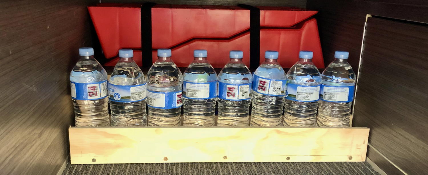
The bottled water was handy but not really essential, since we stayed regularly in campgrounds with a good water supply. Though in a couple of places where the water tasted a bit earthy we did use the bottled water for drinking. (Keep in mind that 1L of water weighs 1Kg, which impacts on your vehicle’s GVM.)
Our longest off-grid spell was 3 nights at Wilpena Pound, but water was readily available there to top up our onboard tank. We have a couple of 5L water containers, a filter, and a funnel, to facilitate the manual transfer and refilling process if required.
All our water refills, and direct connections to campground water outlets, were filtered through our inline B.E.S.T water filter.
Food and Groceries
We carry enough food for meals for around 5 -7 days in our small fridge and freezer, but we do need to regularly pick up bread, milk and fruit.
Every town has a supermarket, often an IGA. Larger towns, like Alice Springs and Port Augusta have both Coles and Woolworths supermarkets.
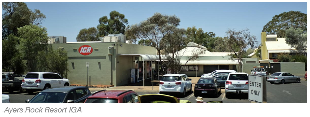
Most roadhouses have a shop with basic groceries and essentials. Ayers Rock Resort has a well-stocked IGA and the shop at Kings Canyon Resort also has a good range of essential food and camping bits and pieces. Be aware that some of these remote resort shops might sell out of fresh fruit early in the morning and may not have more available until the next supply truck arrives in two or three days.
Spud’s Roadhouse at Pimba was also well stocked with camping supplies, including a range of Kings Adventure gear.
The IGA at Coober Pedy is a large store with a wide range of food and groceries, as well as souvenir clothes and a news agency.

Prices vary, depending on location. We enjoy fresh berries with our morning porridge, and often use the price of strawberries / raspberries / blueberries as a price comparison guide. As would be expected, they are generally more expensive in outback towns than in busy coastal towns, often double the cost. The prize for ‘most expensive strawberries’ on our trip went to the IGA at Larapinta, a suburb of Alice Springs – $13 for a punnet. We didn’t buy any, but drove a few kms to the Woolworths store in Alice Springs where they were a more reasonable $8 (‘reasonable’ at least for this part of the world and at this time of the year!).
Campsite options
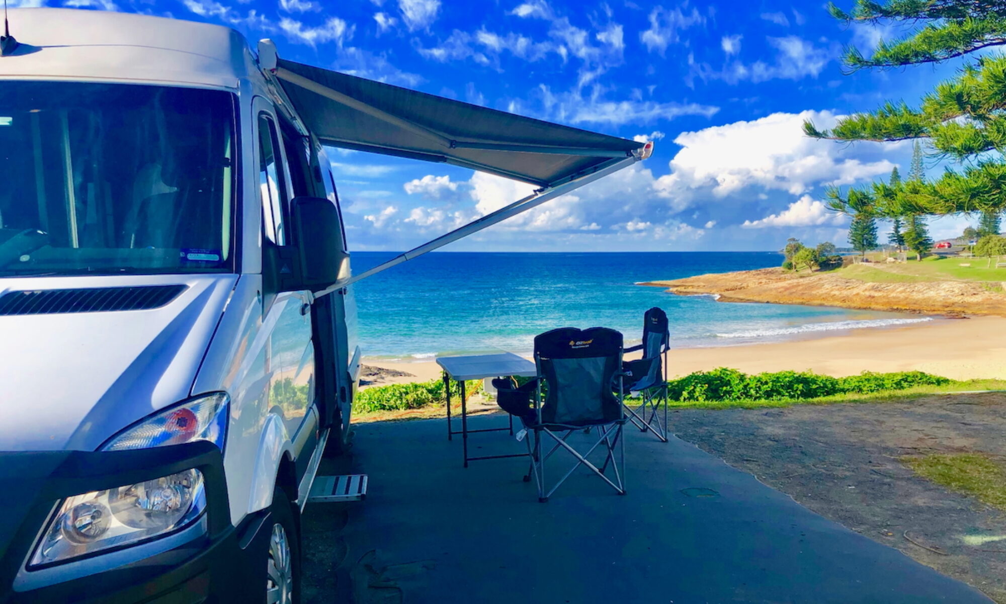
A full range of camping options is available along the way – from completely free camping to full-service caravan parks.
Each town on the main tourist route has regular caravan parks, with shower and toilet amenities, and power and (mostly) water on each site. Prices range from $35 to $55 per night for powered sites, or as low as $10-$15 for unpowered sites – but still with access to shower, toilet, and laundry amenities.
There are plenty of road side rest areas where you can spend the night. Some of these rest areas are close to the road, some are set back from the road. Some have signs indicating that overnight camping is permitted (eg the NT/SA border rest area), while others have no signage at all. There is plenty of highway signage encouraging drivers to use the rest areas to avoid fatigue and death!

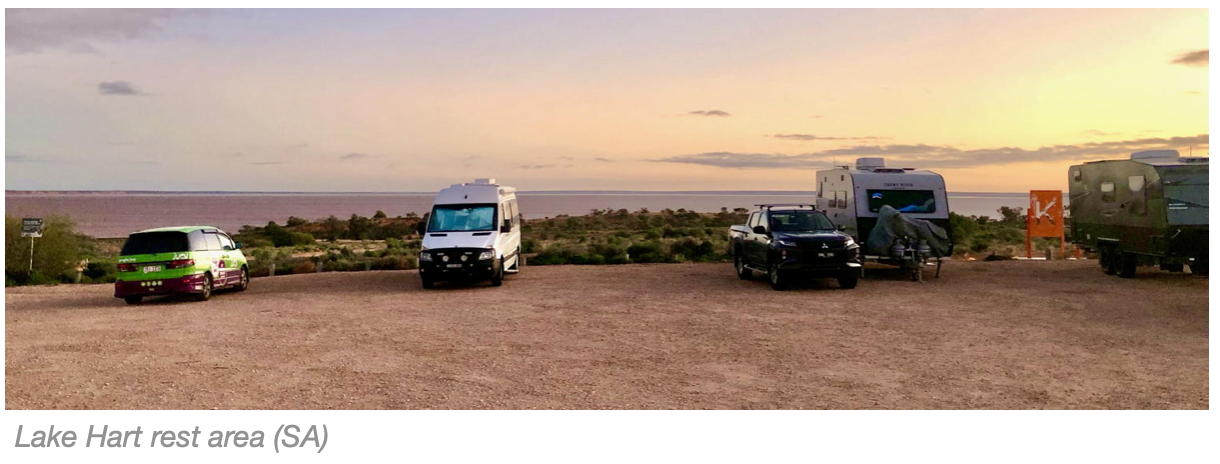
One site where we stayed, and can recommend, is the Lake Hart rest area, just north of Pimba (near Woomera). It is a very popular free-camp location, and had a good Telstra 3G mobile signal. (I understand that in peak season you need to arrive early in the afternoon to secure a spot in the rest area.)
Most national parks offer off-grid camping, not free of cost, but with basic toilets, and no drinking water or power. Facilities vary from park to park.
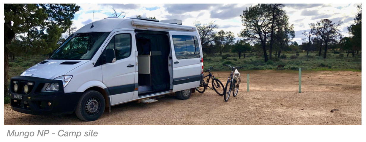
We stayed at Mungo NP in NSW for a couple of nights. No power or water, but there were clean and well-maintained composting toilet facilities, and plenty of sunshine to top up the batteries. (Bookings required.) Mungo Lodge also provides for camping, with access to the lodge facilities – although this info is not listed on their website. Call to book a site.
Wilpena Pound Resort in South Australia’s Ikara-Flinders Ranges NP provides amenities buildings, camp kitchens, powered and non-powered sites, all in a bush setting. Fresh drinking water is available to top up your tanks if you are on a non-powered site. (You need to book well ahead to access one of the powered sites.) A concern for off-grid camping in bushy non-powered national park environments is access to sunlight for solar recharging, if you have a camp site amongst the trees. The National Park also provides a number of camp sites.
Once you are in outback areas, there are no cheap council ‘showground’ sites in local towns – there are very few local towns! In Woomera, for example (a Defence base), you can pay a small fee to stay at the local roadhouse with no power or water (Spuds, at Pimba) or pay a regular site fee for a powered site, with water, at the local caravan park. The park also has unpowered sites available. Or you can pull up for the night at the Lake Hart rest area (see above) for no cost.
There are a number of roadhouses, usually in between towns or tourist destinations, providing powered and non-powered campsites and ammenities…
-
- Erldunda Roadhouse: Conveniently located at the junction of the Stuart and Lasseter highways (turn-off to Uluru and Kings Canyon), and has all the facilities of a regular caravan park, including drive-through sites. Bookings are essential during winter..

-
- Curtin Springs Campground: on the Lasseter highway to Uluru, offers free unpowered camp sites, and some powered sites. About a one hour drive from Uluru;
- Stuarts Well Roadhouse: 90kms south of Alice Springs;
- Marla Traveller’s Rest
- Kulgera Roadhouse
- Spud’s Roadhouse (Pimba/Woomera)
- Cadney Park Roadhouse
Radio, TV and Phone
In a nutshell… there is very little broadcast radio, TV or mobile phone coverage outside of large towns.
|
Network Update The information provided on this page should be considered as legacy information.
If you depend on regular network communications access while travelling get setup with a Starlink Mini service. (Note: This is for use in a campsite, not in a moving vehicle!) |
 Since our trip to the Centre there have been two big changes in network access:
If you depend on online streaming services such as Spotify or Apple Music for your music while driving, start planning an alternative – 4G access between towns or roadhouses is non-existent. Download your favourite playlists to your phone.
We also found that some SIM card service providers that piggy-back on Telstra’s wholesale network don’t necessarily have coverage on all of Telstra’s network – most notably the parts of the network that are provided by third parties such as mining companies and stations. For example, there is good Telstra 4G coverage at Erldunda Roadhouse, but no access for any devices using the Aldimobile service, which uses the Telstra wholesale network. (Ditto for Lake Hart 3G). Fortunately the Erldunda Roadhouse has good WiFi access in the camping area. Check the coverage maps for your service provider.
Telstra is generally regarded as providing the most widespread coverage, claiming “4G access across 99.4% of the population”. As you can see in the Telstra coverage maps below, there is very little 4G or 3G coverage across SA and NT outside the populated areas. (June 2022)
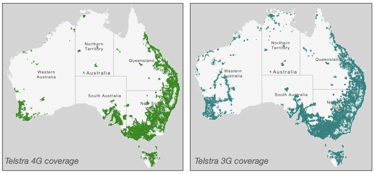
Some roadhouses have 4G/3G network access. We also found that Telstra 3G was available from Port Augusta north to Glendambo, with good Telstra 3G coverage at the Lake Hart rest area (a popular free-camp location).
Keep this limited coverage in mind if you depend on your phone for maps and satellite navigation. Your phone’s navigation service will operate through the satellite system OK if it has made initial route calculations through the mobile phone network while you still have coverage, but cannot initiate a route and connect to the satellite service if it can’t first connect to the phone network.
In these situations you need a dedicated satellite service. As mentioned above, check out Starlink Mini.
Last, but definitely not Least: Be Prepared
-
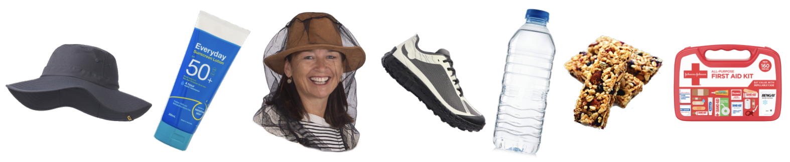
- It is very hot in The Centre in summer – often over 40ºC. Remember, you are in the desert. Be smart – travel to Central Australia in the cooler months – May through to October. Some walking tracks will be closed by the local Rangers in hot weather during summer.
- Many tourist activities involve interacting with the environment, in our case either walking or cycling. Wear an appropriate hat, good walking shoes, and apply sunscreen before leaving on a walk. We did see some intrepid travellers embarking on walking tracks in rough terrain wearing only thongs (flip flops). Just plain stupid.
-
- Even on a relatively short hike you should carry water and snacks.
- You should be carrying a good first aid kit in your van – take some basics with you if going on a hike – bandaids, etc.
- Flys can be extremely annoying at some times of the year – depending on location, weather conditions, etc. A fly net to cover your face is a good thing to carry. These are widely available at tourist outlets in the area, but cheaper to purchase from your local camping supply store before you leave.
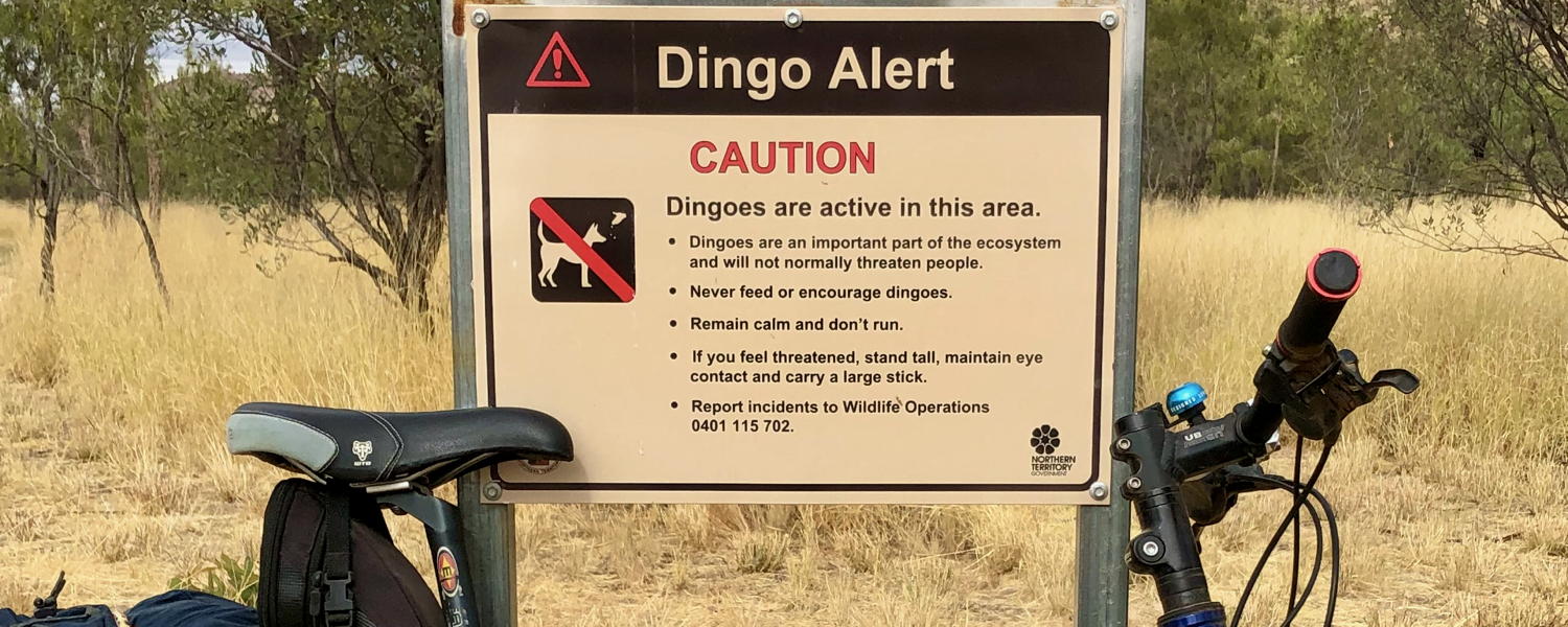
- Keep an eye out for snakes during the warmer months. Also be prepared for unexpected interactions with dingoes – do not feed them. (As noted in the photo below – “stand tall, maintain eye contact, and carry a large stick”!)
- If you are going to be away from the tourist trail, a Personal Locator Beacon might be a useful option in an emergency.
Worth a visit:
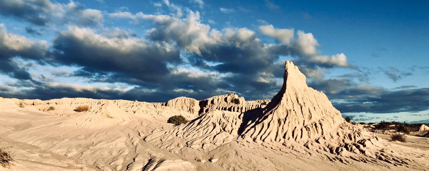
Mungo National Park
Walls of China, at sunset.
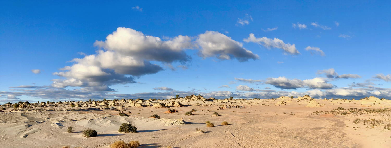
Access to this landscape is only available on an organised tour.
Andamooka (and Roxby Downs)
Woomera, Roxby Downs and Andamooka are worth a detour from the main highway. Sealed road all the way.
Turn off at Pimba, travel out through Woomera and Roxby Downs to Andamooka. There are caravan parks in these towns, and cheap or free camp areas not too far away.
Roxby Downs has a population of around 4000 people, all employed at, or supporting those employed at the Olympic Dam mine.
Andamooka is an old opal mining town – very quirky.

Coober Pedy
Coober Pedy is a handy stopover on the long drive north (or south). The town hosts a number of caravan parks and a coin-operated water-filling station. We stayed at the Oasis Caravan Park – a short walk to the IGA and includes the option of on-site water.
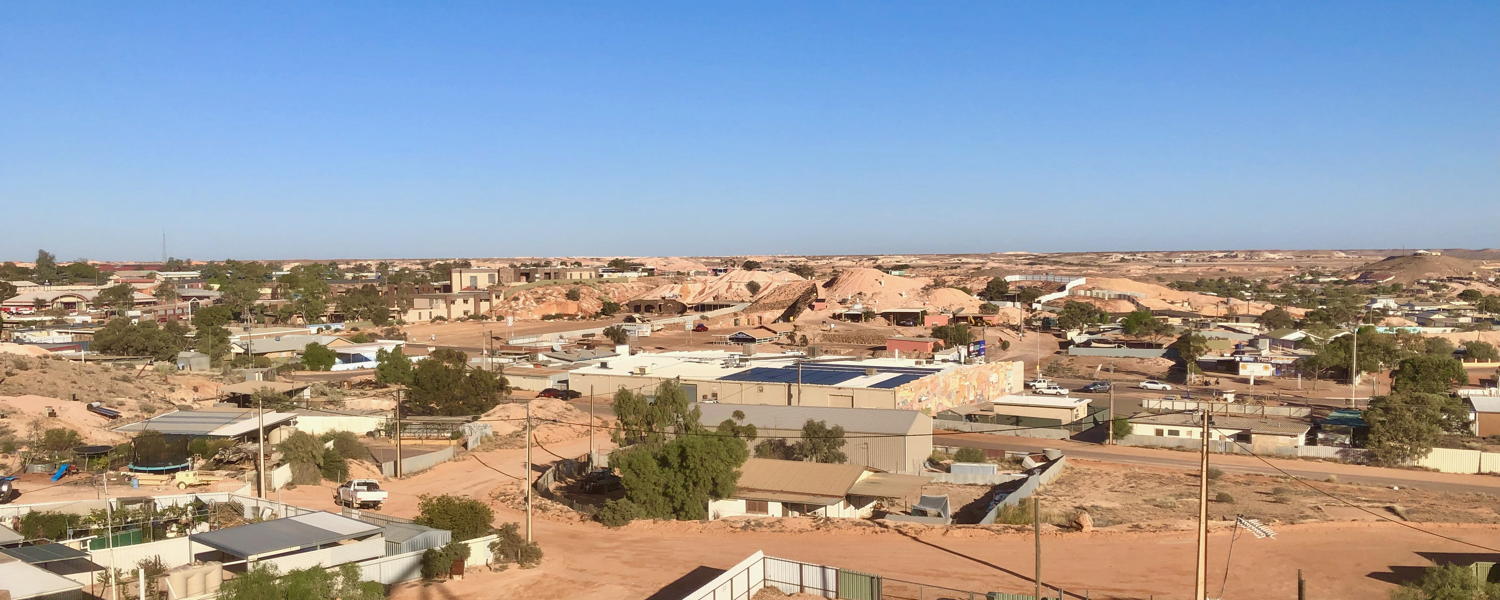
If you haven’t visited an underground house (built inside an old opal mine) before, this is also worth doing. There are plenty of tours available.
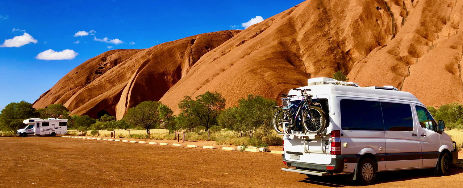
Kings Canyon – Rim walk


The Kings Canyon Rim Walk is a must-do. Access and parking area is 6kms from the resort.
Kings Canyon Resort – Sunset Deck
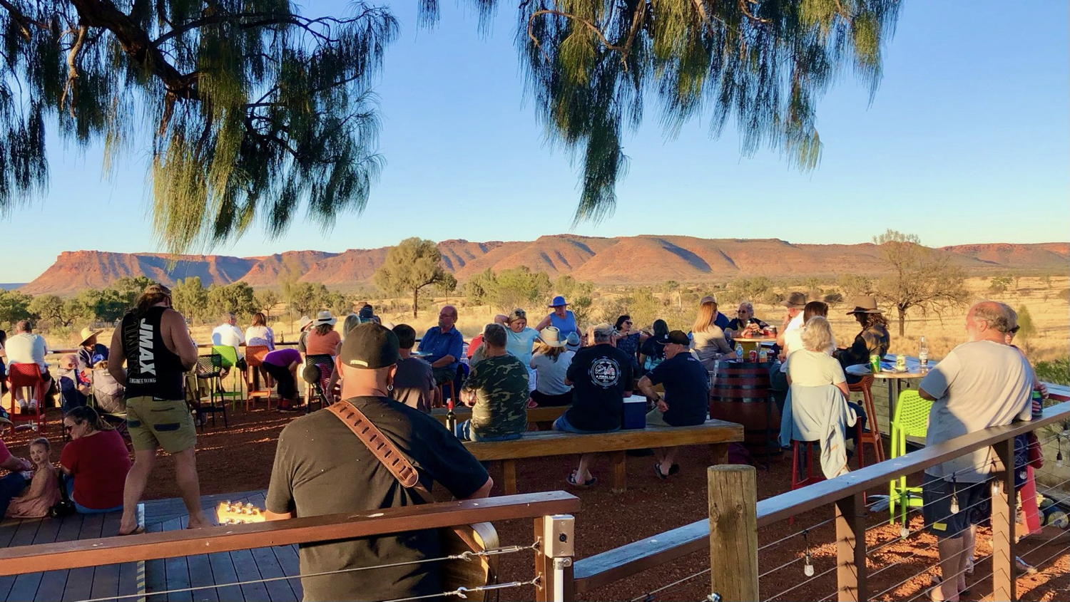
Sunset drinks with music each afternoon at the Kings Canyon Resort.
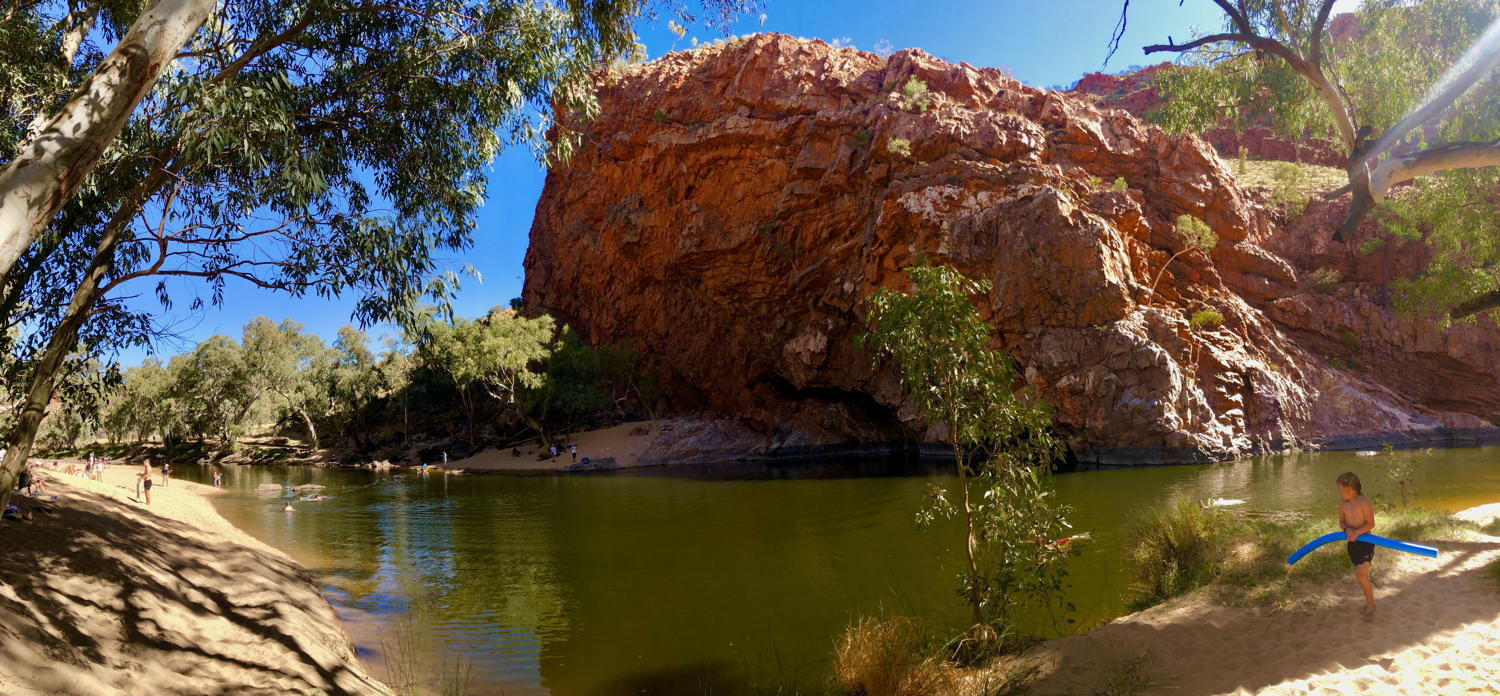
Ormiston Gorge – great swimming hole
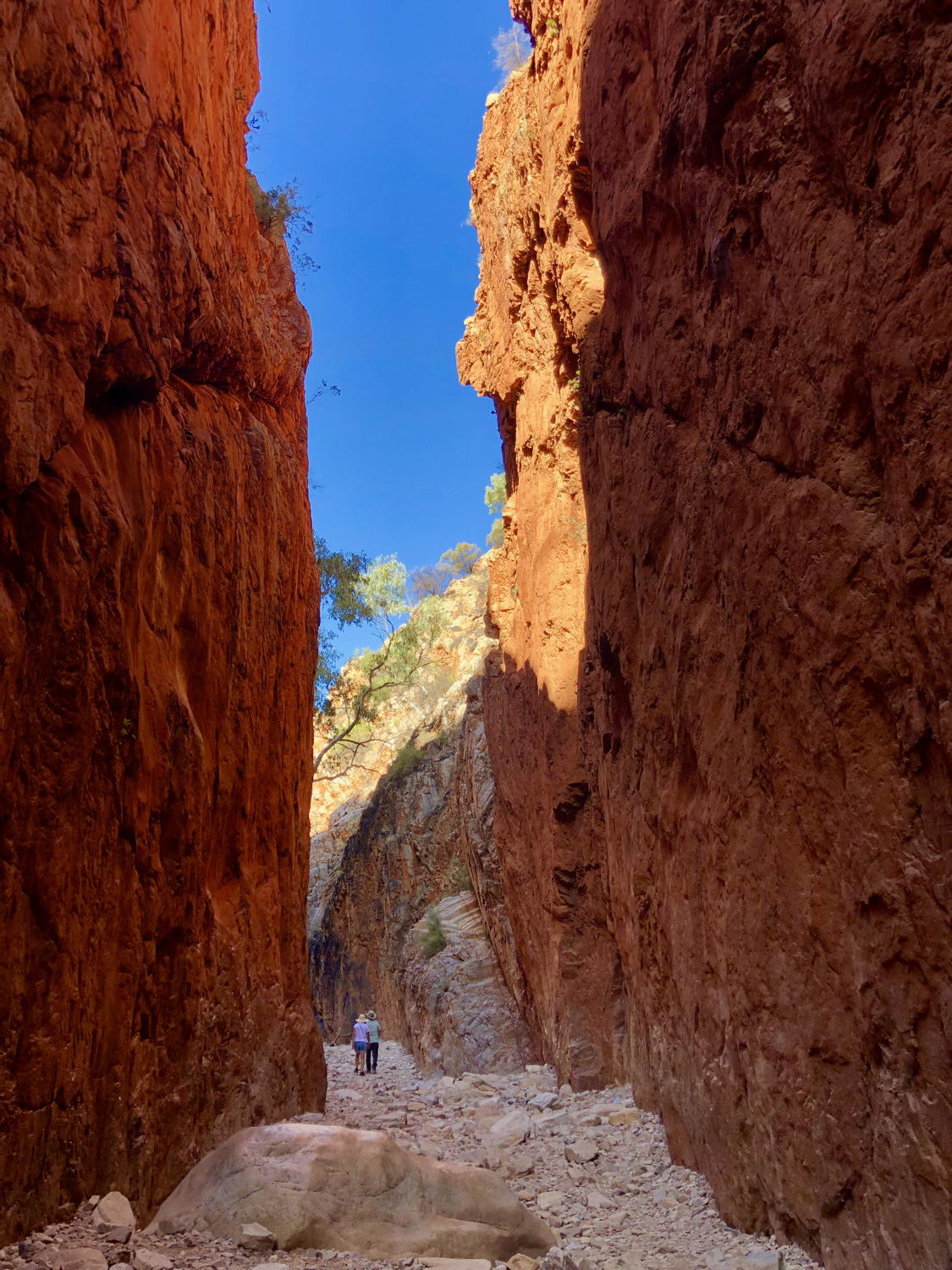
Standley Chasm
Uluru at sunset
Obviously a must visit attraction when you are out this way.
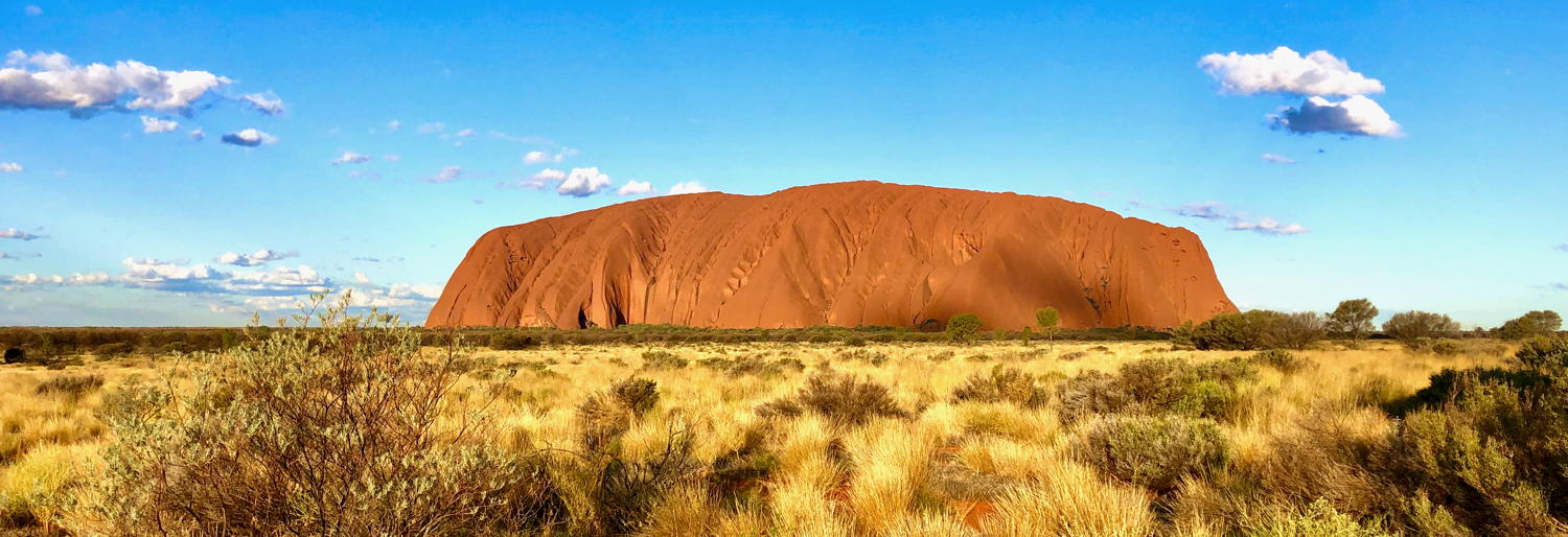
Make sure you have purchased an Uluru – Kata Tjuta National Park entry permit to activate the park boom gate.
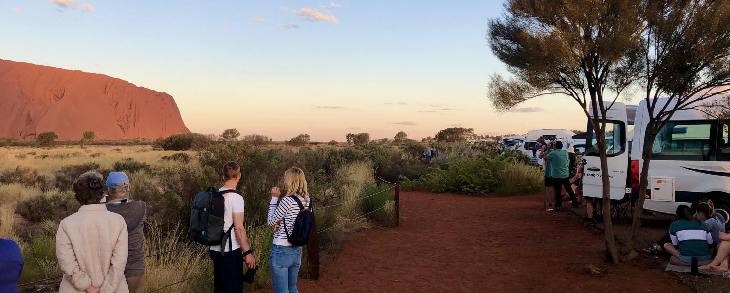
Uluru sunset viewing carpark
Unfold your chairs, break out the drinks and nibbles and join the crowd – and the party atmosphere – along with the zillions of cameras capturing the changing colours of the rock as the sun sets.
Cycling around Uluru
The track encircling Uluru is 10kms – it is a long walk. Cycling makes the trip a more enjoyable couple of hours, with breaks along the way to check out some of the waterholes, caves and significant indigenous locations at the base of the rock.
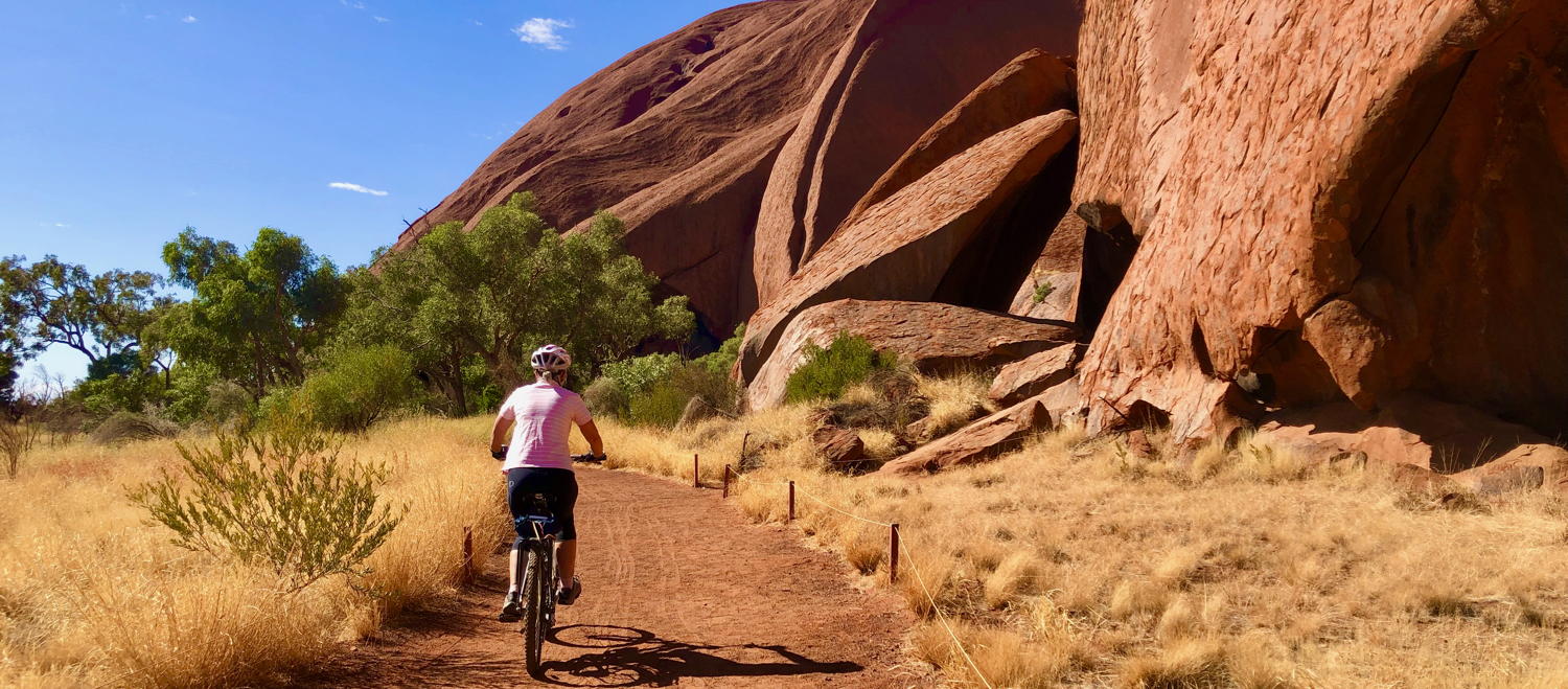
A cycling (or walking) expedition around the base of Uluru provides views from a different perspective….
We parked at the Mala carpark – photo at the top of this page.
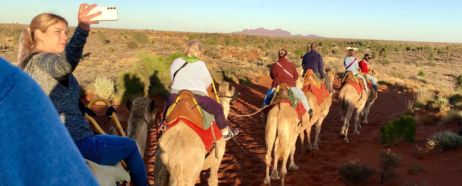
Uluru – Camels at Sunrise

Uluru – Take a helicopter flight
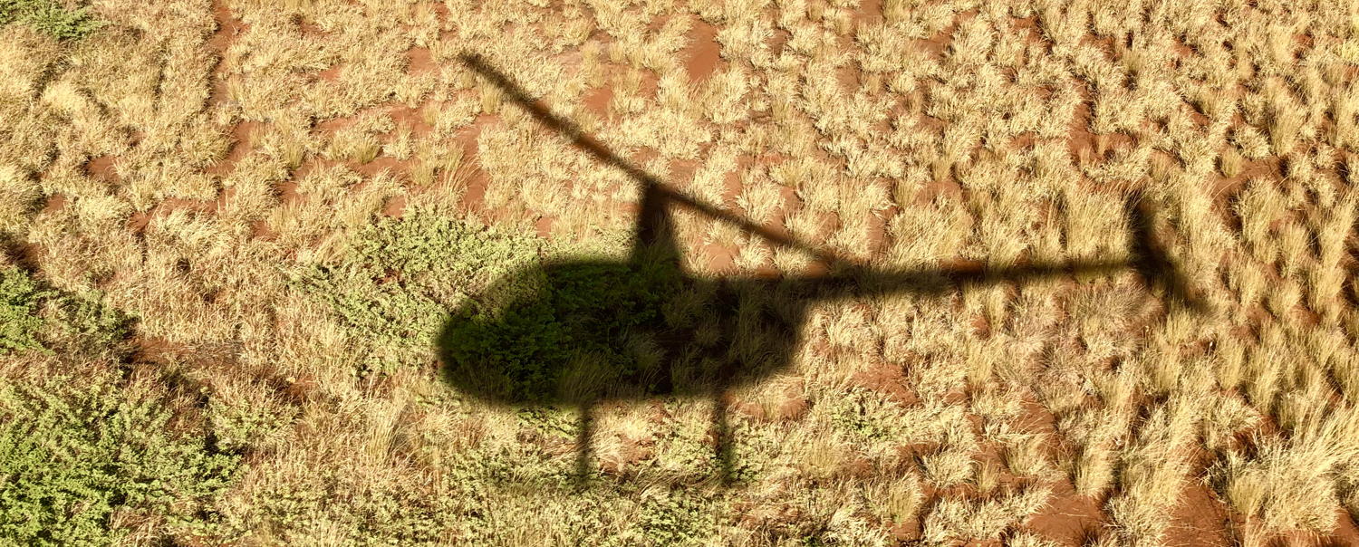
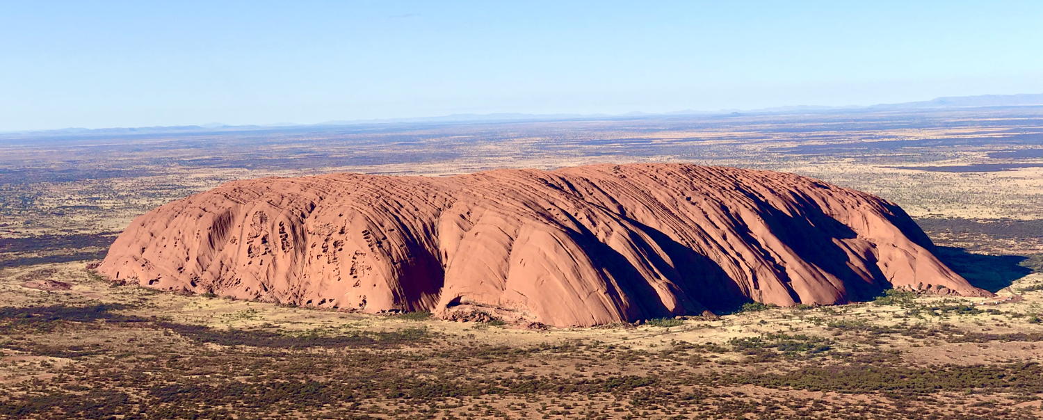
Recommended!
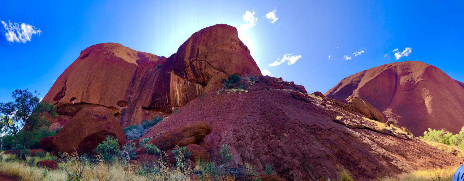
Kata Tjuta

Another must-visit geological attraction, about 45 mins from Uluru. Kata Tjuta rises 200 metres higher above the surrounding plain (546m) than Uluru (348m).
Tips
-
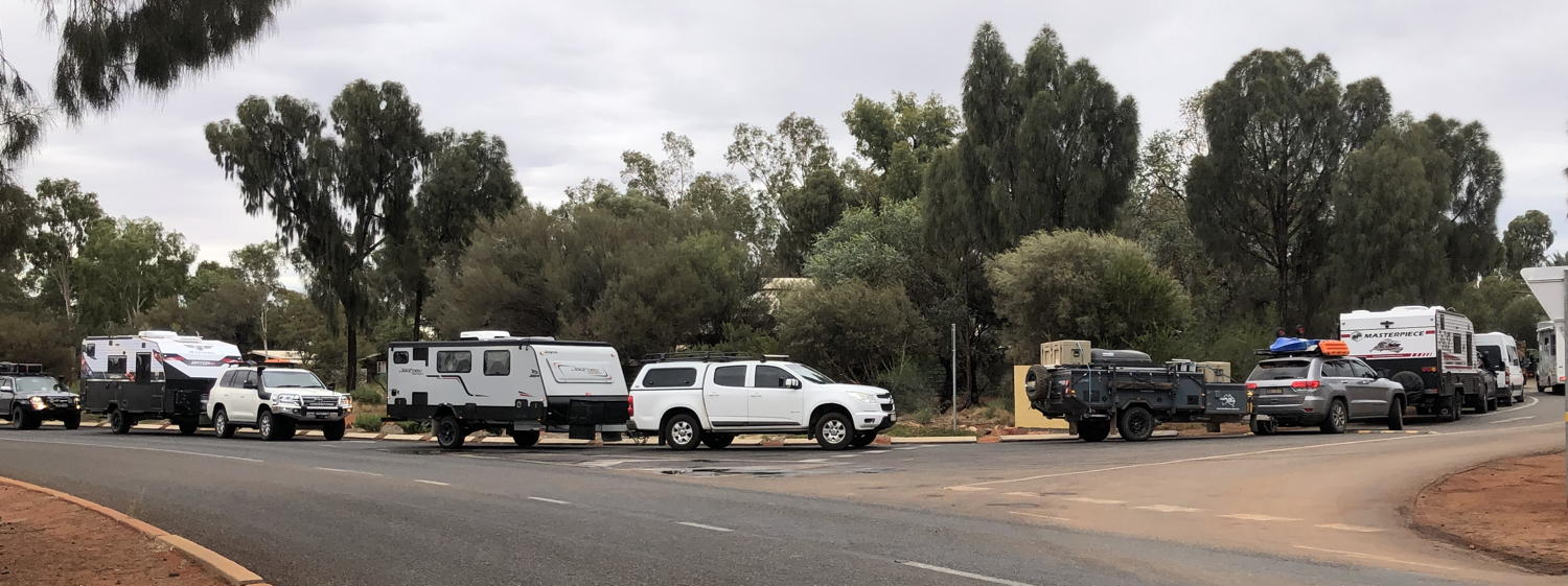
- Ayers Rock Campground – avoid the queue – get there early (like at 11:00!)
-
- Same tip for Uluru sunset viewing at the sunset carpark – be there at least 1 hr before sunset – earlier in peak times I expect.

|
More reading:
|